From the parking area, go back to Platte Clove Road, turn right, and walk along the road for about 750 feet until you see a “Long Path” sign on the left. Enter the woods, heading south on a footpath, and cross Plattekill Creek on a “kingpin” bridge. The Long Path climbs through an attractive evergreen forest, traversing the Platte Clove Preserve of the Catskill Center for Conservation and...
Hike Description:
From the parking area, go back to Platte Clove Road, turn right, and walk along the road for about 750 feet until you see a “Long Path” sign on the left. Enter the woods, heading south on a footpath, and cross Plattekill Creek on a “kingpin” bridge. The Long Path climbs through an attractive evergreen forest, traversing the Platte Clove Preserve of the Catskill Center for Conservation and Development. The trail through the Platte Clove Preserve is marked both with green diamond blazes and with blue blazes with the Long Path logo.
In three-quarters of a mile, you’ll enter the State Forest Preserve. The trail is now blazed with blue DEC blazes. Then, in another 0.2 mile, you’ll reach a junction with the red-blazed Devil’s Path. The trail on the right will be your return route, but for now, continue ahead on the old road, now following red blazes.
In another 350 feet, you’ll come to a second junction. Turn right here and continue to follow the red-blazed Devil’s Path, which begins its climb of Indian Head Mountain.  You’ll gain about 1,000 feet in elevation in 1.25 miles, as the trail ascends the northeast face of the mountain, with level sections alternating with rather steep climbs.
After passing a large overhanging ledge on the left, the trail climbs steeply, then descends a little to Sherman’s Lookout – a northeast-facing rock ledge to the left of the trail. The ledge affords a spectacular view over Platte Clove, with Kaaterskill High Peak in the background, and the Hudson River visible in the distance to the right. You’ll want to take a break here and rest from your arduous climb.
The trail now curves to the right and heads through a spruce forest, running close to the edge of the escarpment for part of the way. A level stretch is followed by a rather steep climb. After traversing a deep evergreen forest, the trail passes a panoramic south-facing viewpoint on the left, then begins a gradual descent.
 At the base of the descent, the trail turns sharply right and climbs very steeply up a cleft in the rock. You’ll need to use both your hands and your feet to negotiate this steep climb (with tree roots providing excellent hand-holds). At the top, an open rock ledge on the right provides another excellent view – this one to the southeast. The knob directly ahead of you is part of Indian Head Mountain (it forms the “chin” of the “Indian,” which you just traversed on the Devil’s Path), and Overlook Mountain (with a fire tower and a communications tower) is on the right. Use extreme caution here, and do not approach the edge, as there is a sheer drop of over 100 feet from this exposed ledge.
The trail continues on a relatively level route until, just before reaching a 50-foot rock face, it turns sharply right and climbs steeply through a crevice. Again, you’ll need to use both your hands and your feet here. The trail soon passes the 3500-foot sign and continues to climb, soon reaching yet another viewpoint from a rock ledge to the left.
The actual summit of the mountain is a short distance beyond the viewpoint. There are no signs to designate this high point, but you’ll know when you’ve reached it, as just beyond, the trail begins a very steep descent. In just half a mile, the trail drops about 500 vertical feet.
At the base of the descent, you’ll come to Jimmy Dolan Notch. The Devil’s Path continues ahead, beginning its climb of Twin Mountain, but you should turn right onto the blue-blazed Jimmy Dolan Notch Trail, which you will follow for the next 1.6 miles. The first part of this trail involves a steep descent, but after descending another 300 vertical feet, the grade moderates, and the trail meanders downhill through a deciduous forest.
After following an old road for about a third of a mile, you’ll cross a stream and reach a trail junction. The Jimmy Dolan Notch Trail ends here, and you should turn right onto the red-blazed Devil’s Path. The trail climbs gradually, then levels off. It crosses two significant streams – one on an interesting rock bridge, and the other on flat rock slabs. Then, after about 1.5 miles, it descends slightly to reach a junction with the trail leading through the Platte Clove Preserve. Turn left and retrace your steps on the Long Path through the Platte Clove Preserve to return to Platte Clove Road, where the hike began.
Publication: Submitted by Daniel Chazin on 08/18/2011 updated/verified on 08/13/2015

This loop hike climbs nearly 2,000 feet to the summit of Indian Head Mountain, with spectacular views.
42.133827, -74.081967
Greene Co., NY
8 mi
6.5 hrs

Buy Map: Catskill Trails Map
Avenza App Map: Catskill 141
Hike Checklist:
Whether you are going for a day hike or backpacking overnight, it is good practice to carry what we call The Hiking Essentials. These essentials will help you enjoy your outing more and will provide basic safety gear if needed. There may also be more essentials, depending on the season and your needs.
The Essentials
Hiking Shoes or Boots
Water - Two quarts per person is recommended in every season. Keep in mind that fluid loss is heightened in winter as well as summer. Don't put yourself in the position of having to end your hike early because you have run out of water.
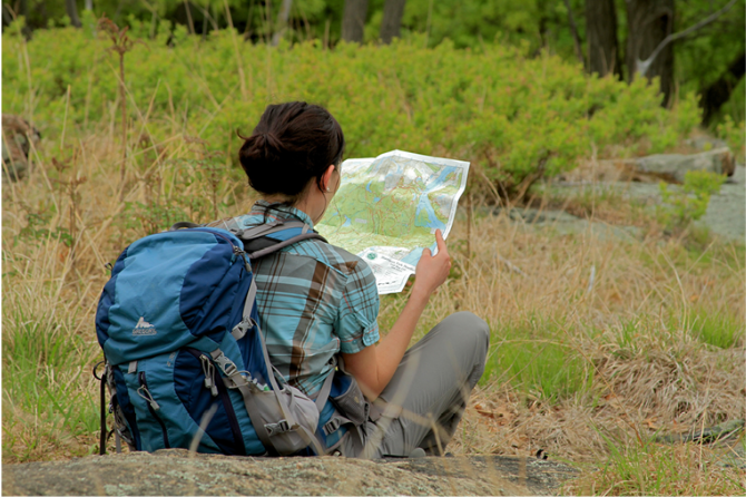
Map - Know where you are and where you are going. Many of our hiking areas feature interconnecting network of trails. Use a waterproof/tear-resistant Tyvek Trail Conference map if available or enclose your map in a Ziplock plastic bag. If you have a mobile device, download Avenza’s free PDF Maps app and grab some GPS-enhanced Trail Conference maps (a backup Tyvek or paper version of the map is good to have just in case your batteries die or you don't have service). Check out some map-reading basics here.
Food - Snacks/lunch will keep you going as you burn energy walking or climbing. Nuts, seeds, and chocolate are favorites on the trail.
Sunscreen and insect repellent
Rain Gear and Extra Clothing - Rain happens. So does cold. Be prepared for changing weather. Avoid cotton--it traps water against your skin and is slow to dry. If you are wearing wet cotton and must return to your starting point, you risk getting chills that may lead to a dangerous hypothermia. Choose synthetic shirts, sweaters and/or vests and dress in layers for easy on and off.
Compass - A simple compass is all you need to orient you and your map to magnetic north.
Light - A flashlight or small, lightweight headlamp will be welcome gear if you find yourself still on the trail when darkness falls. Check the batteries before you start out and have extras in your pack.
First Aid Kit - Keep it simple, compact, and weatherproof. Know how to use the basic components.
Firestarter and Matches - In an emergency, you may need to keep yourself or someone else warm until help arrives. A firestarter (this could be as simple as leftover birthday candles that are kept inside a waterproof container) and matches (again, make sure to keep them in a waterproof container) could save a life.
Knife or Multi-tool - You may need to cut a piece of moleskin to put over a blister, repair a piece of broken equipment, or solve some other unexpected problem.
Emergency Numbers - Know the emergency numbers for the area you're going to and realize that in many locations--especially mountainous ones, your phone will not get reception.
Common Sense - Pay attention to your environment, your energy, and the condition of your companions. Has the weather turned rainy? Is daylight fading? Did you drink all your water? Did your companion fail to bring rain gear? Are you getting tired? Keep in mind that until you turn around you are (typically) only half-way to completing your hike--you must still get back to where you started from! (Exceptions are loop hikes.)
Check the weather forecast before you head out. Know the rules and regulations of the area.
The Leave No Trace Seven Principles
Plan Ahead and Prepare
- Know the regulations and special concerns for the area you'll visit.
- Prepare for extreme weather, hazards, and emergencies.
- Schedule your trip to avoid times of high use.
- Visit in small groups when possible. Consider splitting larger groups into smaller groups.
- Repackage food to minimize waste.
- Use a map and compass to eliminate the use of marking paint, rock cairns or flagging.
Travel and Camp on Durable Surfaces
- Durable surfaces include established trails and campsites, rock, gravel, dry grasses or snow.
- Protect riparian areas by camping at least 200 feet from lakes and streams.
- Good campsites are found, not made. Altering a site is not necessary.
- In popular areas:
- Concentrate use on existing trails and campsites.
- Walk single file in the middle of the trail, even when wet or muddy.
- Keep campsites small. Focus activity in areas where vegetation is absent.
- In pristine areas:
- Disperse use to prevent the creation of campsites and trails.
- Avoid places where impacts are just beginning.
- Pack it in, pack it out. Inspect your campsite and rest areas for trash or spilled foods. Pack out all trash, leftover food and litter.
- Deposit solid human waste in catholes dug 6 to 8 inches deep, at least 200 feet from water, camp and trails. Cover and disguise the cathole when finished.
- Pack out toilet paper and hygiene products.
- To wash yourself or your dishes, carry water 200 feet away from streams or lakes and use small amounts of biodegradable soap. Scatter strained dishwater.
- Preserve the past: examine, but do not touch cultural or historic structures and artifacts.
- Leave rocks, plants and other natural objects as you find them.
- Avoid introducing or transporting non-native species.
- Do not build structures, furniture, or dig trenches.
- Campfires can cause lasting impacts to the backcountry. Use a lightweight stove for cooking and enjoy a candle lantern for light.
- Where fires are permitted, use established fire rings, fire pans, or mound fires.
- Keep fires small. Only use sticks from the ground that can be broken by hand.
- Burn all wood and coals to ash, put out campfires completely, then scatter cool ashes.
- Observe wildlife from a distance. Do not follow or approach them.
- Never feed animals. Feeding wildlife damages their health, alters natural behaviors, and exposes them to predators and other dangers.
- Protect wildlife and your food by storing rations and trash securely.
- Control pets at all times, or leave them at home.
- Avoid wildlife during sensitive times: mating, nesting, raising young, or winter.
Be Considerate of Other Visitors
- Respect other visitors and protect the quality of their experience.
- Be courteous. Yield to other users on the trail.
- Step to the downhill side of the trail when encountering pack stock.
- Take breaks and camp away from trails and other visitors.
- Let nature's sounds prevail. Avoid loud voices and noises.
The Trail Conference is a 2015 Leave No Trace partner.
(c) Leave No Trace Center for Outdoor Ethics: www.LNT.org.
Directions to Trailhead :
Take the New York State Thruway to Exit 20 (Saugerties). After the toll booths, turn left onto N.Y. 212/N.Y. 32, and continue straight ahead at the next intersection to stay on Route 212. In 2.3 miles, turn right onto County Route 35 (Blue Mountain Road). In another 1.5 miles, turn left to continue on County Route 35, now designated as West Saugerties Road. Continue ahead on West Saugerties Road when it becomes County Route 33 and then Platte Clove Road, which climbs through Platte Clove on a steep, narrow road. Just beyond the crest of the rise, turn right at a sign for “trailhead parking” (the sign may be facing the opposite direction) and proceed to the parking area (about 150 feet up a gravel road).
NOTE: The section of Platte Clove Road that climbs steeply from West Saugerties is closed in the winter (from November 1st to April 15th). During this period, the trailhead should be accessed via N.Y. 23A. Take Thruway Exit 20 and turn left after the toll booths onto N.Y. 212/N.Y. 32, but after crossing over the Thruway, turn right onto N.Y. 32. In 6.0 miles, where N.Y. 32 bears right, continue straight ahead onto N.Y. 32A. In 1.9 miles, when N.Y. 32A ends, turn left onto N.Y. 23A and follow it up Kaaterskill Clove and through the village of Haines Falls. At the traffic light in the next village, Tannersville, turn left onto Depot Road and continue ahead on Spruce Street (County Route 16). When Spruce Street ends at a T-intersection, turn left onto Platte Clove Road and continue for 4.9 miles to the trailhead parking area, on the left side of the road.
TRAIN TRANSPORT :
Not availableBUS TRANSPORT :
Not availableShare Your Experience
SUPPORT
 Support the trails with a donation!
Trail Conference volunteers maintain trails in this hike.
Trip Reports
rate experience June 02, 2024
Many Views Are Obstructed, This Hike Is NOT For Dogs
On 5-31-24 I did the Devil's Path/Jimmy Dolan Notch loop from the parking area on Prediger Road, which is most of this route. Many of the viewpoints are obscured by tree cover, and if someone is doing this route for views they may be disappointed. The best view was the southeast one on the right (the third "star" on my 2013 map), and that is a beautiful spot to sit and have lunch. The view from Jimmy Dolan Notch was also obscured, but maybe I didn't go far enough out on the rocks. Before I took the JDN trail back to the parking area, I continued on the Devil's Path to the eastern summit of Twin Mountain, and that is a SPECTACULAR view, and well-worth the climb. Easily the highlight of the day. I then backtracked to the JDN trail, and took it back to the parking area. That trail sure felt like more than 1.6 miles, but perhaps I was just wiped from all the climbing I had done. Total mileage for my hike was 7.2 miles according to my phone, and it took me about 6 hours. All the trail sections I covered are in beautiful shape, and immaculate- I only picked up two small pieces of trash, and had to do a minimal amount of pruning in a few spots. I have nothing but huge respect for the maintainers and sawyers who work on these difficult to access trails. I was looking for the sign indicating 3500 feet, but either it is missing, or I wasn't paying attention when I passed it, as I did not see it. Although the parking area was about 2/3 full when I got there (11 AM), I did not see too many people, just a few here and there, but I did encounter a couple with two dogs who were having trouble getting the larger dog down one of the descents. I tried to assist them, and eventually they were able to get the dog down by going off trail, but I would not recommend bringing your dog on these trails unless you have a harness and ropes, and the dog is comfortable being lifted/lowered with them. Overall, it was an enjoyable day on the trails, and I am looking forward to doing Sugarloaf Mountain the next time I go back to this area.
September 03, 2015
Indian head loop
<p>A very nice loop, and a great introduction (for me) to climbing in the Catskills. I measured the distance as 7.3 miles on my GPS watch. There were two of us, both adults, and we felt the loop could be done in 5 hours or less if one moved along and did not take lengthy breaks. We had a nice viewing of 2 large bear cubs scampering down a nearby tree and then disappearing, to liven up the day. Other than that, very little in the way of wildlife or even birds. The forest was very quiet on our mid-day hike. The description of the hike posted here was very accurate. Great views along the way up and at the summit, such as it is. Hardly any on the way down.</p>
October 08, 2011
great hike!
<p>Did this hike today with the family - or a very similar one. we parked on Prediger Road and did the devil's path / jimmy dolan loop from there instead. trails show signs of a lot of care with much evidence of stone work and corduroy over the many wet patches. a couple of post irine blowdowns still across the trails but nothing that's not easy to bypass. wife and kids made it up the steep scrambles with no complaints, and the views from the overlooks are spectacular. at oct 8 we're probably a week ahead of peak foliage. we detoured to jimmy dolan's notch by following the herd trail behind the sign and enjoyed the view from there too. decent from there was nice and easy. at the car, the GPS read 6.70 miles total for the hike, and we spent a leasurely 6 hour 10 minutes on the trails</p>