From the trailhead, head north on the blue-blazed Guilder Pond Trail, almost immediately crossing a creek on a split log footbridge. The trail follows the shore of Guilder Pond, which is 2,048 feet above sea level, making it the second highest pond in Massachusetts. At times, the trail heads into the hemlock forest, then returns to the pond. After walking for 0.6 mile (three-quarters of the...
Hike Description:
From the trailhead, head north on the blue-blazed Guilder Pond Trail, almost immediately crossing a creek on a split log footbridge. The trail follows the shore of Guilder Pond, which is 2,048 feet above sea level, making it the second highest pond in Massachusetts. At times, the trail heads into the hemlock forest, then returns to the pond. After walking for 0.6 mile (three-quarters of the way around the pond), an unmarked side trail on the right leads you to a large rock ledge overlooking the entire pond. This is a great place to take a break.
When you’re ready to continue, return to the Guilder Pond Trail and turn right. In another 500 feet, you'll come to a junction with the white-blazed Appalachian Trail (A.T.). Turn left onto the A.T., which you will follow all the way to Jug End. In half a mile, you'll pass a sign for the Hemlocks Shelter, rock hop over a creek, then reach a blue-blazed side trail that leads to the Glen Brook Shelter.
In about .75 mile keep left on the AT and rock hop over a creek as the blue-blazed Elbow Trail goes right. The Elbow Trail terminates at the Berkshire School on MA Route 41.
In another half mile you might be tempted to leave the trail to the right, following faint unofficial paths in search of views but resist the urge as there is no need to trample the vegetation as others have done. Before you know it, the Appalachian Trail will deposit you directly on to a rock outcrop at the summit of Mount Bushnell for unobstructed views of the Massachusetts countryside. Look towards the horizon for the highest peak, Mount Greylock, the highest mountain in Massachusetts, about 40 miles away.
Where the trail ascended and descended along a fairly smooth trail up to this point, you will now find the path becomes more rugged with steeper inclines and some short rock scrambles. There will be more views to your right as you continue on, especially during times of no foliage, while traveling along the ridge. At the 4.4-mile point, a large cairn indicates you have reached Jug End but continue on briefly, stopping before the trail drops precipitously, to enjoy the views. Turn around and head back the way you came. Continue straight when the Guilder Pond Trail joins the AT on the boardwalk resulting in white and blue blazes the rest of the way to the upper parking lot.


Hike through old growth forest along Guilder Pond, the highest natural body of water in Massachusetts, then follow the Appalachian Trail along Mount Bushnell’s summit views on the way to Jug End.
42.103508, -73.452774
Berkshire Co., MA
8 mi
5 hrs

Buy Map: *NEW* South Taconic Trails Map
Avenza App Map: South Taconic 107
Hike Checklist:
Whether you are going for a day hike or backpacking overnight, it is good practice to carry what we call The Hiking Essentials. These essentials will help you enjoy your outing more and will provide basic safety gear if needed. There may also be more essentials, depending on the season and your needs.
The Essentials
Hiking Shoes or Boots
Water - Two quarts per person is recommended in every season. Keep in mind that fluid loss is heightened in winter as well as summer. Don't put yourself in the position of having to end your hike early because you have run out of water.
Map - Know where you are and where you are going. Many of our hiking areas feature interconnecting network of trails. Use a waterproof/tear-resistant Tyvek Trail Conference map if available or enclose your map in a Ziplock plastic bag. If you have a mobile device, download Avenza’s free PDF Maps app and grab some GPS-enhanced Trail Conference maps (a backup Tyvek or paper version of the map is good to have just in case your batteries die or you don't have service). Check out some map-reading basics here.
Food - Snacks/lunch will keep you going as you burn energy walking or climbing. Nuts, seeds, and chocolate are favorites on the trail.
Sunscreen and insect repellent
Rain Gear and Extra Clothing - Rain happens. So does cold. Be prepared for changing weather. Avoid cotton--it traps water against your skin and is slow to dry. If you are wearing wet cotton and must return to your starting point, you risk getting chills that may lead to a dangerous hypothermia. Choose synthetic shirts, sweaters and/or vests and dress in layers for easy on and off.
Compass - A simple compass is all you need to orient you and your map to magnetic north.
Light - A flashlight or small, lightweight headlamp will be welcome gear if you find yourself still on the trail when darkness falls. Check the batteries before you start out and have extras in your pack.
First Aid Kit - Keep it simple, compact, and weatherproof. Know how to use the basic components.
Firestarter and Matches - In an emergency, you may need to keep yourself or someone else warm until help arrives. A firestarter (this could be as simple as leftover birthday candles that are kept inside a waterproof container) and matches (again, make sure to keep them in a waterproof container) could save a life.
Knife or Multi-tool - You may need to cut a piece of moleskin to put over a blister, repair a piece of broken equipment, or solve some other unexpected problem.
Emergency Numbers - Know the emergency numbers for the area you're going to and realize that in many locations--especially mountainous ones, your phone will not get reception.
Common Sense - Pay attention to your environment, your energy, and the condition of your companions. Has the weather turned rainy? Is daylight fading? Did you drink all your water? Did your companion fail to bring rain gear? Are you getting tired? Keep in mind that until you turn around you are (typically) only half-way to completing your hike--you must still get back to where you started from! (Exceptions are loop hikes.)
Check the weather forecast before you head out. Know the rules and regulations of the area.
The Leave No Trace Seven Principles
Plan Ahead and Prepare
- Know the regulations and special concerns for the area you'll visit.
- Prepare for extreme weather, hazards, and emergencies.
- Schedule your trip to avoid times of high use.
- Visit in small groups when possible. Consider splitting larger groups into smaller groups.
- Repackage food to minimize waste.
- Use a map and compass to eliminate the use of marking paint, rock cairns or flagging.
Travel and Camp on Durable Surfaces
- Durable surfaces include established trails and campsites, rock, gravel, dry grasses or snow.
- Protect riparian areas by camping at least 200 feet from lakes and streams.
- Good campsites are found, not made. Altering a site is not necessary.
- In popular areas:
- Concentrate use on existing trails and campsites.
- Walk single file in the middle of the trail, even when wet or muddy.
- Keep campsites small. Focus activity in areas where vegetation is absent.
- In pristine areas:
- Disperse use to prevent the creation of campsites and trails.
- Avoid places where impacts are just beginning.
- Pack it in, pack it out. Inspect your campsite and rest areas for trash or spilled foods. Pack out all trash, leftover food and litter.
- Deposit solid human waste in catholes dug 6 to 8 inches deep, at least 200 feet from water, camp and trails. Cover and disguise the cathole when finished.
- Pack out toilet paper and hygiene products.
- To wash yourself or your dishes, carry water 200 feet away from streams or lakes and use small amounts of biodegradable soap. Scatter strained dishwater.
- Preserve the past: examine, but do not touch cultural or historic structures and artifacts.
- Leave rocks, plants and other natural objects as you find them.
- Avoid introducing or transporting non-native species.
- Do not build structures, furniture, or dig trenches.
- Campfires can cause lasting impacts to the backcountry. Use a lightweight stove for cooking and enjoy a candle lantern for light.
- Where fires are permitted, use established fire rings, fire pans, or mound fires.
- Keep fires small. Only use sticks from the ground that can be broken by hand.
- Burn all wood and coals to ash, put out campfires completely, then scatter cool ashes.
- Observe wildlife from a distance. Do not follow or approach them.
- Never feed animals. Feeding wildlife damages their health, alters natural behaviors, and exposes them to predators and other dangers.
- Protect wildlife and your food by storing rations and trash securely.
- Control pets at all times, or leave them at home.
- Avoid wildlife during sensitive times: mating, nesting, raising young, or winter.
Be Considerate of Other Visitors
- Respect other visitors and protect the quality of their experience.
- Be courteous. Yield to other users on the trail.
- Step to the downhill side of the trail when encountering pack stock.
- Take breaks and camp away from trails and other visitors.
- Let nature's sounds prevail. Avoid loud voices and noises.
The Trail Conference is a 2015 Leave No Trace partner.
(c) Leave No Trace Center for Outdoor Ethics: www.LNT.org.
Directions to Trailhead :
Take N.Y. Route 22 north to Copake Falls, and proceed east on N.Y. Route 344 through Taconic State Park. In 1.8 miles, you enter Massachusetts, and the name of the road changes to Falls Road. In another 1.9 miles, turn right onto West Street. Continue for 1.1 miles, then turn left onto Cross Street. Make the first left onto East Street and continue for 0.3 mile to the entrance to Mount Everett State Reservation (on the right). Turn right and follow the gravel Mount Everett Road for 0.9 mile to the parking area. From the parking area, walk back on the road for 0.2 mile to the trailhead of the blue-blazed Guilder Pond Trail (on the right)
If Mount Everett Road is closed to traffic, you can park before the gate and walk along the road for 0.7 mile to the trailhead of the Guilder Pond Trail (on the left). This will add 1.6 miles to the distance of the hike.
TRAIN TRANSPORT :
Not availableBUS TRANSPORT :
Not available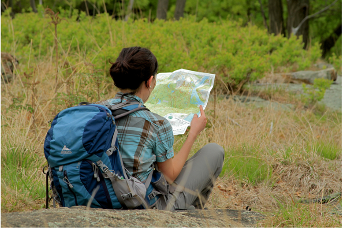
 Support the trails with a donation!
Trip Reports
rate experience November 18, 2012
Guilder Pond Loop trail closed
<p>We went to MA to do this hike today. The gates were open (the sign says they close at 8pm). We stopped at the small parking area right at Guilder Pond, and there was a sign saying the Guilder Pond Loop trail was closed due to unsafe conditions. We continued to the second parking area (much larger) and got onto the AT from there. There were a number of blowdowns at the beginning of the hike.</p>