The Saddle River Pathway extends along the Saddle River from Wild Duck Pond, just north of East Ridgewood Avenue in Ridgewood, to Railroad Avenue in Rochelle Park, a distance of six miles. The trail is a paved multi-use path, open to walkers, joggers and bicyclists. Suburban development can be seen along the trail for much of its way (especially when there are no leaves on the trees), and it...
Hike Description:
The Saddle River Pathway extends along the Saddle River from Wild Duck Pond, just north of East Ridgewood Avenue in Ridgewood, to Railroad Avenue in Rochelle Park, a distance of six miles. The trail is a paved multi-use path, open to walkers, joggers and bicyclists. Suburban development can be seen along the trail for much of its way (especially when there are no leaves on the trees), and it certainly does not offer a wilderness experience. But it does provide the opportunity to walk for six miles through the center of Bergen County while paralleling a scenic stream, and without crossing at grade a single road open to through traffic! It’s also easy to keep track how far you have gone, as there are small mileage signs along the trail each tenth of a mile.
The pathway begins on the park access road just beyond the parking area, where a sign points to “Glen Rock/Fair Lawn/Dunkerhook.” Follow the paved path under East Ridgewood Avenue and continue south along the Saddle River. At first, an office building and several homes directly abut the pathway on the right, but after half a mile, the corridor widens to include parkland to the west.
At 0.8 mile, the trail reaches Grove Street and bears left to parallel it. Then, in another 0.2 mile, it passes beneath the overpass carrying Grove Street and continues south, with the river on the left and Ridgewood’s Grove Park on the right. Homes can be seen through the trees on the opposite side of the river, but the trail soon begins to traverse a more pristine section, with parkland on both sides.
The trail crosses a bridge over a tributary stream at 1.6 miles and reaches a T-intersection. Here, you should turn left, following the sign to “Dunkerhook/Fair Lawn.” After passing a small dam in the Saddle River, the trail turns left and crosses a bridge over the river. At the next T-intersection, turn right onto a road open to vehicular traffic (it is the exit from a parking area), following the sign for “Saddle Brook/Rochelle Park.”
Proceed ahead on this road, which curves to the left and parallels the river. At a “stop” sign, again bear right to continue along the river. The site of the former Dunkerhook Road bridge is passed at 2.3 miles, after which the trail bears right and crosses the Saddle River on a newer bridge.
On the other side of the bridge, you’ll reach a T-intersection. Here, you should turn left, following the sign for “Saddle Brook/Rochelle Park,” and pass through an open grassy area, with tennis courts on the right.
At 2.8 miles, the trail goes under the Century Road bridge. Just beyond, turn left, following the sign for “Saddle Brook.” The trail now runs close to houses on the right (a path which leads to the right provides access for local residents, but you should continue ahead along the river), then traverses a more pristine area.
After passing through an open area with grassy expanses, the trail turns left at 3.6 miles, once more crosses to the east bank of the Saddle River, and begins to parallel Paramus Road, with a Greek Orthodox Church on the left. At 3.9 miles, a path leading to Paramus Road joins from the left, but you should bear right, proceeding under the Route 4 bridge on a walkway built over the river.
Just beyond, at 4.0 miles, the path ahead leads to the historic Easton Tower, built In 1899 on the site of a former gristmill. You should turn right, cross a bridge over the river, and reach the intersection of Saddle River Road and Red Mill Road. Here, you turn left, proceed under the Red Mill Road bridge on a walkway built over the river, then bear left to continue along the river.
After approaching Saddle River Road, the trail passes behind homes and reaches several ballfields. At 4.5 miles, it goes by a parking area (for the park and ballfields), crosses its entrance road, then briefly parallels the road. Soon, another path leaves to the right, but you should continue ahead, following the sign for “Rochelle Park,” and pass a playground on the right.
Soon, you’ll hear the Garden State Parkway on the left, across the river (if there are no leaves on the trees, you’ll also be able to see it). To the right, a path circles a pond, with the two paths running directly parallel to each other. After bearing left at 5.0 miles and crossing under the Parkway, you’ll come to another intersection where, on the left, a bridge crosses the river.
For the rest of the way, there are parallel paths on both sides of the river, but you should proceed ahead along the west side, following the official route of the pathway. The trail now passes several ballfields and open grassy areas. After crossing a culvert over a stream, the trail continues through a wooded area to end, 6.0 miles from the start, on Saddle River Road, just north of its intersection with Railroad Avenue.
Turn left onto Saddle River Road, then immediately left onto Railroad Avenue. If you have parked a car at the southern end of the hike, turn left at the entrance to Saddle River County Park. If you have only one car, you can return to the start of the hike via public transportation. Cross the Railroad Avenue bridge over the Saddle River, then turn left onto a paved path that parallels a road on the right. After passing tennis and basketball courts on the right, turn right onto a paved road that leads out to Rochelle Avenue. Turn left onto Rochelle Avenue and walk for 0.5 mile to Passaic Street. Cross the street, turn right and proceed one block south on Passaic Street to a stop for the #163 bus, which takes you back to the start (go to www.njtransit.com for a schedule).
Publication: Submitted by Georgette Weir on 01/04/2008 updated/verified on 09/25/2017


This nearly-level hike follows the Saddle River from Ridgewood to Rochelle Park, passing through the heart of Bergen County on a scenic corridor.
40.973916, -74.0931
Bergen Co., NJ
6 mi
3 hrs

Web Map: Bergen County Parks Department map
Hike Checklist:
Whether you are going for a day hike or backpacking overnight, it is good practice to carry what we call The Hiking Essentials. These essentials will help you enjoy your outing more and will provide basic safety gear if needed. There may also be more essentials, depending on the season and your needs.
The Essentials
Hiking Shoes or Boots
Water - Two quarts per person is recommended in every season. Keep in mind that fluid loss is heightened in winter as well as summer. Don't put yourself in the position of having to end your hike early because you have run out of water.
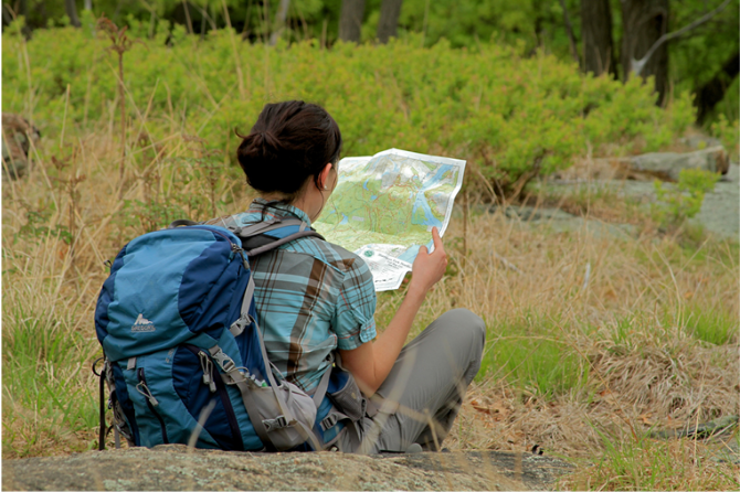
Map - Know where you are and where you are going. Many of our hiking areas feature interconnecting network of trails. Use a waterproof/tear-resistant Tyvek Trail Conference map if available or enclose your map in a Ziplock plastic bag. If you have a mobile device, download Avenza’s free PDF Maps app and grab some GPS-enhanced Trail Conference maps (a backup Tyvek or paper version of the map is good to have just in case your batteries die or you don't have service). Check out some map-reading basics here.
Food - Snacks/lunch will keep you going as you burn energy walking or climbing. Nuts, seeds, and chocolate are favorites on the trail.
Sunscreen and insect repellent
Rain Gear and Extra Clothing - Rain happens. So does cold. Be prepared for changing weather. Avoid cotton--it traps water against your skin and is slow to dry. If you are wearing wet cotton and must return to your starting point, you risk getting chills that may lead to a dangerous hypothermia. Choose synthetic shirts, sweaters and/or vests and dress in layers for easy on and off.
Compass - A simple compass is all you need to orient you and your map to magnetic north.
Light - A flashlight or small, lightweight headlamp will be welcome gear if you find yourself still on the trail when darkness falls. Check the batteries before you start out and have extras in your pack.
First Aid Kit - Keep it simple, compact, and weatherproof. Know how to use the basic components.
Firestarter and Matches - In an emergency, you may need to keep yourself or someone else warm until help arrives. A firestarter (this could be as simple as leftover birthday candles that are kept inside a waterproof container) and matches (again, make sure to keep them in a waterproof container) could save a life.
Knife or Multi-tool - You may need to cut a piece of moleskin to put over a blister, repair a piece of broken equipment, or solve some other unexpected problem.
Emergency Numbers - Know the emergency numbers for the area you're going to and realize that in many locations--especially mountainous ones, your phone will not get reception.
Common Sense - Pay attention to your environment, your energy, and the condition of your companions. Has the weather turned rainy? Is daylight fading? Did you drink all your water? Did your companion fail to bring rain gear? Are you getting tired? Keep in mind that until you turn around you are (typically) only half-way to completing your hike--you must still get back to where you started from! (Exceptions are loop hikes.)
Check the weather forecast before you head out. Know the rules and regulations of the area.
The Leave No Trace Seven Principles
Plan Ahead and Prepare
- Know the regulations and special concerns for the area you'll visit.
- Prepare for extreme weather, hazards, and emergencies.
- Schedule your trip to avoid times of high use.
- Visit in small groups when possible. Consider splitting larger groups into smaller groups.
- Repackage food to minimize waste.
- Use a map and compass to eliminate the use of marking paint, rock cairns or flagging.
Travel and Camp on Durable Surfaces
- Durable surfaces include established trails and campsites, rock, gravel, dry grasses or snow.
- Protect riparian areas by camping at least 200 feet from lakes and streams.
- Good campsites are found, not made. Altering a site is not necessary.
- In popular areas:
- Concentrate use on existing trails and campsites.
- Walk single file in the middle of the trail, even when wet or muddy.
- Keep campsites small. Focus activity in areas where vegetation is absent.
- In pristine areas:
- Disperse use to prevent the creation of campsites and trails.
- Avoid places where impacts are just beginning.
- Pack it in, pack it out. Inspect your campsite and rest areas for trash or spilled foods. Pack out all trash, leftover food and litter.
- Deposit solid human waste in catholes dug 6 to 8 inches deep, at least 200 feet from water, camp and trails. Cover and disguise the cathole when finished.
- Pack out toilet paper and hygiene products.
- To wash yourself or your dishes, carry water 200 feet away from streams or lakes and use small amounts of biodegradable soap. Scatter strained dishwater.
- Preserve the past: examine, but do not touch cultural or historic structures and artifacts.
- Leave rocks, plants and other natural objects as you find them.
- Avoid introducing or transporting non-native species.
- Do not build structures, furniture, or dig trenches.
- Campfires can cause lasting impacts to the backcountry. Use a lightweight stove for cooking and enjoy a candle lantern for light.
- Where fires are permitted, use established fire rings, fire pans, or mound fires.
- Keep fires small. Only use sticks from the ground that can be broken by hand.
- Burn all wood and coals to ash, put out campfires completely, then scatter cool ashes.
- Observe wildlife from a distance. Do not follow or approach them.
- Never feed animals. Feeding wildlife damages their health, alters natural behaviors, and exposes them to predators and other dangers.
- Protect wildlife and your food by storing rations and trash securely.
- Control pets at all times, or leave them at home.
- Avoid wildlife during sensitive times: mating, nesting, raising young, or winter.
Be Considerate of Other Visitors
- Respect other visitors and protect the quality of their experience.
- Be courteous. Yield to other users on the trail.
- Step to the downhill side of the trail when encountering pack stock.
- Take breaks and camp away from trails and other visitors.
- Let nature's sounds prevail. Avoid loud voices and noises.
The Trail Conference is a 2015 Leave No Trace partner.
(c) Leave No Trace Center for Outdoor Ethics: www.LNT.org.
Directions to Trailhead :
To reach the start of the hike, take Route 17 to the Ridgewood Avenue exit, heading towards Ridgewood. Follow Ridgewood Avenue for about one mile to the entrance to Wild Duck Pond County Park (on the right). Enter the park and follow the loop road to the last parking area on the right.
If you have two cars, you will want to park one at each end of the hike. (If you have only one car, you can return to the start by public transportation.) To reach the southern end of the hike, take I-80 to Exit 63 and follow Riverview Avenue to Essex Street. Turn left onto Essex Street, then turn right at the next traffic light onto Rochelle Avenue. Take the next left onto Railroad Avenue and turn right at the entrance to Saddle River County Park. Leave one car here. With the other car, take Railroad Avenue back to Rochelle Avenue and turn left. Continue for one mile and turn left onto Route 17 north. Follow Route 17 for four miles to the Ridgewood Avenue exit, and see directions above.
TRAIN TRANSPORT :
Not availableBUS TRANSPORT :
The trailhead can be reached by taking NJ Transit #163 bus to the intersection of Paramus Road and East Ridgewood Avenue in Ridgewood and walking west on East Ridgewood Avenue to the park.
 Support the trails with a donation!
Trip Reports
rate experience January 27, 2013
NJUrbanForest.com Virtual Tour of Saddle River Park!
<p>Join NJUrbanForest.com on a photo filled virtual tour of Bergen County's Saddle River Park!</p>
<p>http://njurbanforest.com/2010/08/04/saddle-river-county-park/</p>
December 30, 2011
Be alert for bicycles
<p>They frequently approach from the rear and don't always ring their bells, if they have one.</p>