From the parking area, follow the white blazes of the White Bar Trail (horizontal white rectangles, some of which may be marked with the letters "W-B"), which proceeds uphill, heading southwest. (Do not cross Route 106.) When you come to a fork at the top of a rise, bear left and follow the White Bar Trail as it descends rather steeply and then climbs a second hill, known as Carr Pond Mountain...
Hike Description:
From the parking area, follow the white blazes of the White Bar Trail (horizontal white rectangles, some of which may be marked with the letters "W-B"), which proceeds uphill, heading southwest. (Do not cross Route 106.) When you come to a fork at the top of a rise, bear left and follow the White Bar Trail as it descends rather steeply and then climbs a second hill, known as Carr Pond Mountain, on a steady grade. The trail goes just west of the summit. As the trail begins to descend, you will find a good viewpoint to the southwest from open rocks to the right of the trail.
Continue along the White Bar Trail as it descends to Parker Cabin Hollow, where it crosses a stream on a wooden bridge and joins an old woods road. The trail now begins a steady ascent. After about half a mile, it reaches a junction with the yellow-blazed Triangle Trail. Turn left and follow the joint White Bar/Triangle Trail for a short distance. When the two trails split, bear left and continue on the yellow-blazed Triangle Trail. In another half a mile, after a short climb, the Triangle Trail reaches an intersection with the red-on-white-blazed Ramapo-Dunderberg (R-D) Trail at the top of Parker Cabin Mountain. Turn left and follow the joint Triangle/R-D Trail along the ridge for about 150 feet. When the two trails split, turn right and follow the Triangle Trail for a short distance down to a viewpoint from a rock ledge. The lake visible in the distance is Lake Sebago. This is a good spot to take a break.
When you're ready to continue, retrace your steps to the Triangle/R-D junction and turn right, now following the red-on-white blazes of the R-D Trail heading north. The trail continues along the ridge and then descends over bare slabs of rock. In about half a mile, it reaches a low point where there is an old stone fireplace. Here, the R-D crosses the Victory Trail, marked with a blue "V" on white. Continue ahead on the R-D Trail, which now steeply ascends Tom Jones Mountain. At the summit, there are broad views to the east. The towers visible in the distance are on Jackie Jones Mountain. If you look carefully, you will see a fire tower to the right of the taller communications towers.
Follow the R-D Trail as it descends to the northeast, with more views along the trail as you descend. At the base of the descent, the trail crosses Route 106 at a parking area. It briefly turns right and parallels the road, then turns left and heads into the woods, soon beginning to climb Black Rock Mountain. In about half a mile, it reaches a junction with the white-blazed Nurian Trail at a broad viewpoint. Turn left at this junction and follow the Nurian Trail downhill to an intersection with the White Bar Trail. (Although both trails are blazed white, the distinctive horizontal shape of the White Bar blazes makes them easy to distinguish from the Nurian blazes.) Turn left onto the White Bar Trail and follow it back to Route 106, where the trail turns left, parallels the road for a short distance, and then crosses the road into the parking area where the hike began.
Publication: Submitted by Daniel Chazin on 09/12/2002 updated/verified on 11/13/2014

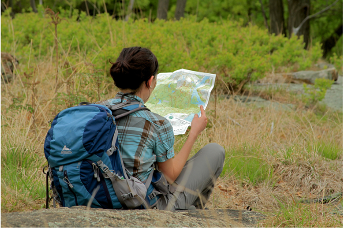
This loop hike climbs five peaks, with several good views, and much up-and-down hiking.
41.234516, -74.148972
Orange Co., NY
5 mi
3 hrs

Avenza App Map: Harriman-Bear Mountain 118
Directions to Trailhead :
Take N.Y. Route 17 north through Sloatsburg and Tuxedo. About 2.3 miles north of the Tuxedo railroad station, take the exit (on the left) for Route 17A. Turn right at the top of the ramp onto Kanawauke Road (formerly County Route 106) and continue for 2.2 miles to a Hikers' Trailhead Parking Area on the right, just beyond a sharp curve.
TRAIN TRANSPORT :
Not availableBUS TRANSPORT :
Not availableShare Your Experience
SUPPORT
 Support the trails with a donation!
Trail Conference volunteers maintain trails in this hike.
Trip Reports
rate experience September 17, 2020
Back Three Years Later . . .
As I searched on September 13, 2020 for a moderate to strenuous hike in the 4-6 mile range, I ended up back here, looking at my own comments from exactly three years earlier. In the first half mile there were a lot of downed trees from the previous August storm that had not yet been cut by the sawyer crew. In most cases, hikers had already created spontaneous detours around the trail-blocks. I found most of the description accurate with the same exception: just after Parker Cabin Hollow and the wooden bridge, the trail joins an old woods road turning left, but you will also see orange blazes turning right that mark the start of the Parker Cabin Hollow Trail heading to the west - that made me think twice (again) before turning left/east on the White Bar trail. Late in the hike I was careful this time to anticipate the start of the Nurian trail from the R-D trail where one must turn left up and over the open rock viewpoint to continue on Nurian. I think this spot is one of my favorite viewpoints in Harriman. Heading down from the rock outcrop, watch carefully for blazes, as there are various offshoots of the trail in the first tenth of a mile. As always, I really enjoyed the open stretches of the R-D trail, following glacial striations and getting regular views. In this season of COVID-19, on a beautiful hiking day, there were a fair number of fellow hikers and a lot of campers near the Tom Jones shelter, all but a few following guidelines for masks and distance. I also verified the 5.0 mile distance with an AllTrails recording, and recorded a total ascent of about 1,400 feet.
September 11, 2017
Great 3-Hour Hike From Easier Parking
Took this loop in early September 2017, and found the description to be accurate. There are a number of ups and downs, but not that tough and ascents are not so long. A few comments on the description: just after Parker Cabin Hollow and the wood bridge the trail joins an old woods road but you will also see orange blazes that mark the start of the Parker Cabin Hollow Trail heading to the west - that made me think twice before turning left/east on the White Bar trail. Later, I had to search (like the previous reviewer) for the start of the Nurian trail from the R-D trail. The three three blazes of the start of Nurian are prominent, but one must turn left up and over the open rock viewpoint to continue on Nurian. Watch carefully for blazes, as there are various offshoots of the trail in the first tenth of a mile. As always, I really enjoyed the open stretches of the R-D trail, following glacial striations and getting regular views. Be careful crossing Route 106 in motorcycle season.
February 25, 2017
Tough one, but worth it
Enjoyed the hike on a way too early Spring day on 25 Feb. R106 was closed, but we took the chance drove past the barriers and found the road clear. I suspect they close it over the winter because they don't plow the snow. Unlike last weekend's slashy hike in Sterling, there was no sign of snow today.
There are lot of ups and downs and some are a decent climb. The views are worth it. Make sure you swing by the shelter which you will see to the right, .15 mile after you crossed the Victory trial.
Don't be tempted to head straight back to your car when you get to R106. Cross it a little lower to the right and enjoy the gradual climb to the top of Black Rock. Make sure you turn left when you see the blazes for the start of the White trail. I saw the Red blaze, that we were on, and three White blazes and for some reason ignored it. Hike about .25 mile until I realized that we're going in the wrong direction.
Would love to do it in the late summer again.