This hike loops around the Rocky Point Pine Barrens State Forest. Although the area is not “barren,” the trees in this preserve are mostly pitch pines and scrub oak, both of which are relatively low growing. The terrain is largely flat, and there are no streams or ponds along the trail. But aside from two road crossings and a short section where some buildings are visible in the distance,...
Hike Description:
This hike loops around the Rocky Point Pine Barrens State Forest. Although the area is not “barren,” the trees in this preserve are mostly pitch pines and scrub oak, both of which are relatively low growing. The terrain is largely flat, and there are no streams or ponds along the trail. But aside from two road crossings and a short section where some buildings are visible in the distance, there is hardly any evidence of civilization along the route of the hike. Although both mountain bikes and horses are allowed in the preserve, separate trails are provided for bicyclists and equestrians, and neither bicycles nor horses are permitted on the hiking trails. Hiking in the preserve is not permitted during the January firearms deer season (certain weekdays in early January).
The area traversed by the hike has an interesting history. It was acquired by the Radio Corporation of America (RCA) in the early part of the twentieth century and used as a transmitting facility for international radio communications. Numerous antennae and towers were erected on the property. By the 1970s, the technology used had become obsolete, and RCA donated the property to the State of New York. Along the hike, you’ll encounter a number of concrete foundations – all that remains of the various towers and antenna that once were located throughout the property. The property is now managed by the New York State Department of Environmental Conservation (DEC).
From the parking area, head into the woods, following the red DEC blazes and the white blazes of the Paumanok Path through a dense pitch pine forest. The area that you’re traversing was devastated by a forest fire on August 22, 1995. A hiker who visited the area three days later reported that “it resembled the moon – it was just black and gray with no sign of life of any kind.” It’s hard to believe that in the intervening 20 years, a thriving pitch pine forest has regenerated, to the point that if you didn’t know about the fire, you’d never guess that the area had been burned so recently.
In 0.4 mile, you’ll reach a junction marked by a signpost. The blue trail on the left will be your return route, but bear right and continue ahead, now following only the red blazes. In another 500 feet, you’ll cross a woods road. The preserve is crossed by many such roads, some of which were used by RCA to provide access to the property. Note that the vegetation north of this woods road is primarily scrub oak, rather than the pitch pines you’ve hiked through up to this point.
You’ll cross another woods road in about half a mile. Just beyond, you’ll pass an open clearing on the right. This clearing is maintained by the DEC for the benefit of game birds that frequent the area. The trail now makes a few turns and soon crosses two bike trails.
Next, you’ll come to a complex intersection, where the red trail crosses a woods road, turns left on another woods road, crosses a bike trail, then immediately turns right onto a wide woods road that might have been built by RCA to access its transmitters. As you head north on this road, ascending very gently, you’ll notice that the surrounding forest is mostly oak, with only a few pine trees. The land slopes down to the right into Telegraph Hollow, named after an old telephone pole that still stands at the bottom of the hollow.
After crossing three more woods roads, the trail begins a rather steep climb to the top of Sand Hill (elevation 210 feet), twice crossing a bike trail on the way up. This is the only significant climb on the entire hike. At the summit, you’ll notice a small concrete foundation with a piece of a pole sticking out. This is the first remnant along the hike of the previous use of the property by RCA.
The trail turns left and soon begins a rather steep descent on a woods road. At the base of the descent, it turns sharply left onto a footpath. Just ahead, you’ll cross another bike trail and then a woods road, and you’ll reenter a pitch pine forest. After crossing two more woods roads, you’ll notice four concrete footings on the left.
The trail now crosses several more woods roads and bike trails and makes several sharp turns. It crosses the paved Rocky Point Road, 4.3 miles from the start of the hike. Use caution while crossing the road, as cars travel at high speed, the sight distance to the north is limited, and there are no signs to warn motorists of the trail crossing. You’ll notice that the forest on the west side of the road is almost exclusively composed of scrub oak.
In a short distance, you’ll reach a junction with a yellow-blazed trail that goes off to the left at a signpost. Continue ahead on the red trail, which soon crosses a former firebreak. The firebreak is now grown in with young pitch pines, which are an interesting contrast to the scrub oak forest that surrounds it. The trail now passes behind Rocky Point High School, with a chain-link fence marking the boundary of the preserve. This is the only place along the trail (besides the two road crossings) where civilization encroaches on the trail.
Nearly a mile from the crossing of Rocky Point Road, the trail turns left onto a woods road, passing a stand of cedars. Also evident in this area are barberry bushes – an invasive species that is often found in areas where the soil has been disturbed. This is the only location along the hike where this unattractive invasive species is found.
Just ahead, the trail turns right on an old paved road. In a short distance, you’ll reach a junction with another old paved road. Turn left here, leaving the red trail, and begin to follow the blue trail, which is co-aligned with the white-blazed Paumanok Path. The trail turns left, then immediately turns right onto a footpath. You’ve now hiked 5.2 miles from the start of the hike.
You now pass through an area with many large trees – quite different from the pitch pines and scrub oaks you’ve encountered up to this point. A short distance beyond, you’ll pass some holly trees, and then you’ll reach a large glacial erratic, known as Sitting Rock, on the left side of the trail. The trail now begins a gradual climb, passing through a mature pitch pine/scrub oak forest. This area is the southern edge of the Harbor Hill Moraine, and the trail traverses undulating terrain.
About half a mile from the junction with the red trail, you’ll pass on the left the other end of the yellow-blazed trail that you encountered previously. Soon, the trail again levels off, and you’ll cross two former firebreaks that are now revegetated with dense stands of young pitch pines. In each case, there are woods roads along each side of the firebreak, and the first firebreak also has a woods road running down the middle. The firebreaks are easily noticeable because the pitch pines are a sharp contrast to the rest of the forest, which is primarily scrub oak.
In another half mile, you’ll descend into a shallow kettlehole – a depression formed by a retreating glacier. Beyond the kettlehole, pitch pines again begin to dominate the forest. Soon, you’ll cross another woods road, with a concrete foundation and holly trees on the right just beyond.
The trail continues through a pitch pine/scrub oak forest, heading south. In about a mile, after crossing a woods road, the trail curves left and begins to head east. Here, you’ll pass a concrete foundation on the right, with a large clearing (maintained by the DEC) beyond.
After crossing two more woods roads and a narrow bike trail, you’ll pass an interesting carved granite block on the left, with cables attached to the block. A short distance beyond, you’ll again reach paved Rocky Point Road. You’ve now hiked about 8.7 miles from the start of the hike.
Cross the road and continue along the blue/white trail, soon crossing another woods road and entering a dense young pitch pine forest – revegetating an area scorched by the fire of August 1995. After a while, the trail jogs to the right and enters an area with taller and less dense trees. It traverses another dense pitch pine forest, crosses a narrower woods road, then heads through a forest dominated by oaks.
A short distance beyond, the trail climbs a mound, with a concrete foundation covered with moss on the top. Just beyond, there are a number of large concrete foundations on both sides of the trail. Pitch pines briefly dominate, but the oak forest soon resumes.
Just over 10 miles from the start of the hike, you’ll reach the junction of the blue and red trails that you were at near the start of the hike. Here the blue trail ends, and you should turn right onto the red trail and retrace your steps back to the parking area where the hike began.
Publication: Submitted by Daniel Chazin on 04/10/2016

This loop hike traverses the Long Island Pine Barrens and passes remnants of the former use of the property by the RCA Corporation.
40.908134, -72.921539
Suffolk Co., NY
11 mi
5.5 hrs

Hike Checklist:
Whether you are going for a day hike or backpacking overnight, it is good practice to carry what we call The Hiking Essentials. These essentials will help you enjoy your outing more and will provide basic safety gear if needed. There may also be more essentials, depending on the season and your needs.
The Essentials
Hiking Shoes or Boots
Water - Two quarts per person is recommended in every season. Keep in mind that fluid loss is heightened in winter as well as summer. Don't put yourself in the position of having to end your hike early because you have run out of water.
Map - Know where you are and where you are going. Many of our hiking areas feature interconnecting network of trails. Use a waterproof/tear-resistant Tyvek Trail Conference map if available or enclose your map in a Ziplock plastic bag. If you have a mobile device, download Avenza’s free PDF Maps app and grab some GPS-enhanced Trail Conference maps (a backup Tyvek or paper version of the map is good to have just in case your batteries die or you don't have service). Check out some map-reading basics here.
Food - Snacks/lunch will keep you going as you burn energy walking or climbing. Nuts, seeds, and chocolate are favorites on the trail.
Sunscreen and insect repellent
Rain Gear and Extra Clothing - Rain happens. So does cold. Be prepared for changing weather. Avoid cotton--it traps water against your skin and is slow to dry. If you are wearing wet cotton and must return to your starting point, you risk getting chills that may lead to a dangerous hypothermia. Choose synthetic shirts, sweaters and/or vests and dress in layers for easy on and off.
Compass - A simple compass is all you need to orient you and your map to magnetic north.
Light - A flashlight or small, lightweight headlamp will be welcome gear if you find yourself still on the trail when darkness falls. Check the batteries before you start out and have extras in your pack.
First Aid Kit - Keep it simple, compact, and weatherproof. Know how to use the basic components.
Firestarter and Matches - In an emergency, you may need to keep yourself or someone else warm until help arrives. A firestarter (this could be as simple as leftover birthday candles that are kept inside a waterproof container) and matches (again, make sure to keep them in a waterproof container) could save a life.
Knife or Multi-tool - You may need to cut a piece of moleskin to put over a blister, repair a piece of broken equipment, or solve some other unexpected problem.
Emergency Numbers - Know the emergency numbers for the area you're going to and realize that in many locations--especially mountainous ones, your phone will not get reception.
Common Sense - Pay attention to your environment, your energy, and the condition of your companions. Has the weather turned rainy? Is daylight fading? Did you drink all your water? Did your companion fail to bring rain gear? Are you getting tired? Keep in mind that until you turn around you are (typically) only half-way to completing your hike--you must still get back to where you started from! (Exceptions are loop hikes.)
Check the weather forecast before you head out. Know the rules and regulations of the area.
The Leave No Trace Seven Principles
Plan Ahead and Prepare
- Know the regulations and special concerns for the area you'll visit.
- Prepare for extreme weather, hazards, and emergencies.
- Schedule your trip to avoid times of high use.
- Visit in small groups when possible. Consider splitting larger groups into smaller groups.
- Repackage food to minimize waste.
- Use a map and compass to eliminate the use of marking paint, rock cairns or flagging.
Travel and Camp on Durable Surfaces
- Durable surfaces include established trails and campsites, rock, gravel, dry grasses or snow.
- Protect riparian areas by camping at least 200 feet from lakes and streams.
- Good campsites are found, not made. Altering a site is not necessary.
- In popular areas:
- Concentrate use on existing trails and campsites.
- Walk single file in the middle of the trail, even when wet or muddy.
- Keep campsites small. Focus activity in areas where vegetation is absent.
- In pristine areas:
- Disperse use to prevent the creation of campsites and trails.
- Avoid places where impacts are just beginning.
- Pack it in, pack it out. Inspect your campsite and rest areas for trash or spilled foods. Pack out all trash, leftover food and litter.
- Deposit solid human waste in catholes dug 6 to 8 inches deep, at least 200 feet from water, camp and trails. Cover and disguise the cathole when finished.
- Pack out toilet paper and hygiene products.
- To wash yourself or your dishes, carry water 200 feet away from streams or lakes and use small amounts of biodegradable soap. Scatter strained dishwater.
- Preserve the past: examine, but do not touch cultural or historic structures and artifacts.
- Leave rocks, plants and other natural objects as you find them.
- Avoid introducing or transporting non-native species.
- Do not build structures, furniture, or dig trenches.
- Campfires can cause lasting impacts to the backcountry. Use a lightweight stove for cooking and enjoy a candle lantern for light.
- Where fires are permitted, use established fire rings, fire pans, or mound fires.
- Keep fires small. Only use sticks from the ground that can be broken by hand.
- Burn all wood and coals to ash, put out campfires completely, then scatter cool ashes.
- Observe wildlife from a distance. Do not follow or approach them.
- Never feed animals. Feeding wildlife damages their health, alters natural behaviors, and exposes them to predators and other dangers.
- Protect wildlife and your food by storing rations and trash securely.
- Control pets at all times, or leave them at home.
- Avoid wildlife during sensitive times: mating, nesting, raising young, or winter.
Be Considerate of Other Visitors
- Respect other visitors and protect the quality of their experience.
- Be courteous. Yield to other users on the trail.
- Step to the downhill side of the trail when encountering pack stock.
- Take breaks and camp away from trails and other visitors.
- Let nature's sounds prevail. Avoid loud voices and noises.
The Trail Conference is a 2015 Leave No Trace partner.
(c) Leave No Trace Center for Outdoor Ethics: www.LNT.org.
Directions to Trailhead :
Take the Long Island Expressway east to Exit 66. Proceed north for 6.0 miles, and turn right onto Whiskey Road. Follow Whiskey Road for 1.1 miles and turn into a parking area (with the large number “18") on the left side of the road.
TRAIN TRANSPORT :
Not availableBUS TRANSPORT :
Not available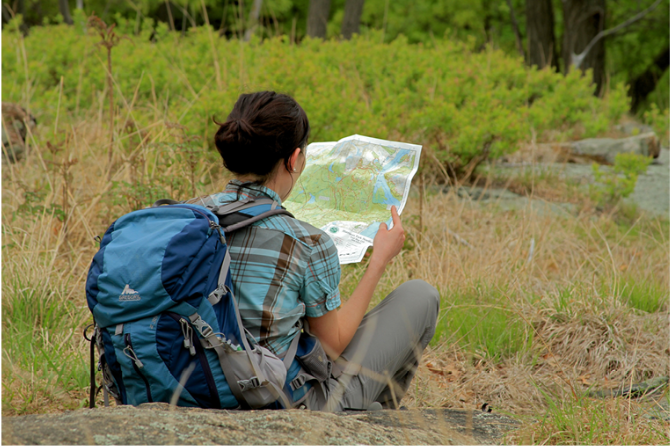
 Support the trails with a donation!
Trip Reports
rate experience May 30, 2022
Peaceful, If Somewhat Monotonous Stroll In The Woods
Pease note that a permit from DEC is required to hike on these trails. I did this hike on 5-29-22.
I started the hike at the north end, at the parking area on 25A where the red and blue trails connect. I hiked in the opposite direction (clockwise) of this description, starting on the red trail, then following the blue trail back to the parking area. The trails are well-maintained, with only a few minor blowdowns, and as stated in the description, just about the entire hike is on level ground. It took me a little over 4 hours to complete, and I only saw two other people while i was hiking.
This is a peaceful area once you get away from 25A, and the other paved road crossings. Use caution at those road crossings- no one is heeding the speed limit. Overall, i would say this is a good hike if you just want to walk in the forest without a lot of ascents/descents, and if you aren't looking for pretty lake or rock cliff type views.