From the east end of the Massapequa station, take the exit to the north and head east on a paved path between the railroad tracks and a chain-link fence. In about 500 feet, you’ll come to a T-intersection with a wide paved path. This is the route of the white-blazed Nassau-Suffolk Greenbelt Trail, here coaligned with the paved bike path. Turn left, following the white blazes, and proceed north...
Hike Description:
From the east end of the Massapequa station, take the exit to the north and head east on a paved path between the railroad tracks and a chain-link fence. In about 500 feet, you’ll come to a T-intersection with a wide paved path. This is the route of the white-blazed Nassau-Suffolk Greenbelt Trail, here coaligned with the paved bike path. Turn left, following the white blazes, and proceed north along the west shore of the Massapequa Reservoir. Just ahead, a short side trail on the right leads down to the reservoir.
A short distance beyond, follow the white blazes which turn left, leaving the paved path, and head into the woods on a footpath. For the rest of the hike, the hiking trail and the bike path will follow separate routes, briefly following a joint route at road crossings.
After crossing Clark Avenue, the trail goes through a wetland, with puncheons placed along wet sections of the trail. Soon, the trail turns left onto a wide dirt-and-gravel path that runs along the west side of a pond. In 500 feet, as the wide path curves left, you should bear right, continuing ahead on a narrow footpath. The trail now curves to the right, crosses an inlet of the pond on a wooden footbridge, and continues through an open area along the north side of the pond.
Soon, the trail bears left and reenters the woods. It traverses another wet area, with long stretches of puncheons. The trail continues north on a footpath until it reaches an open grassy area, with Massapequa Creek on the right. Here, the trail bears right at a fork. Just beyond, it turns right, crosses a stream on a wooden bridge and reenters the woods. It bears left at a fork, then right at the next fork, and crosses another stream on a wooden bridge.
Soon, you’ll notice some tall pitch pines in the forest of deciduous trees. Although the eastern end of Long Island is known for its pine barrens, pitch pines are not often found this far west on the island. You’ll traverse a trail section that features many exposed roots, with the trail covered in places with pine needles.
About two miles from the start of the hike, the trail turns left onto a wide dirt road, then turns right again and heads north on another dirt road, with homes visible through the trees on the left. Soon, the trail reaches paved Linden Street. It turns right and follows a path along the road for 200 feet, then turns left and crosses Linden Street just beyond an entrance ramp to the Southern State Parkway.
On the north side of Linden Street, the trail bears right and follows a narrow corridor between Linden Street and a ramp of the parkway. It then curves left, climbs the embankment, and turns right, parallel to the parkway ramp. Just ahead, it joins the paved bike path that comes in from the right and continues parallel to the ramp, crossing over the Southern State Parkway and continuing over another bridge that goes over a ramp to the Bethpage State Parkway. The trail now passes a small pond on the right and continues ahead on the paved bike path.
In 500 feet, the Nassau-Suffolk Greenbelt Trail bears left, leaving the bike path, and follows a footpath into the woods. For the next 2.5 miles, the trail heads north along a narrow corridor for the Bethpage State Parkway. For much of the way, the view of the parkway is obscured by the vegetation, but you are never far away from this busy road.
The Nassau-Suffolk Greenbelt Trail crosses a footbridge over a creek, parallels the creek for some distance, then begins to run close to the paved bike path. After about a mile, the trail rejoins the bike path and soon reaches the intersection of West Drive and Northwest Drive. Here, it crosses an exit ramp from the parkway and goes under the Boundary Avenue overpass. Just north of the overpass, the trail bears left, leaving the bike path, and meanders through a narrow corridor between the parkway on the left and the bike path on the right. Along the way, it passes through a stand of pitch pines and holly.
In another mile, just south of Hempstead Turnpike, the Nassau-Suffolk Greenbelt Trail comes out at an exit ramp from the Parkway. The trail turns right and follows the exit ramp to the paved bike path. It turns left onto the bike path, crosses the exit ramp, then passes beneath the Hempstead Turnpike overpass. Just beyond, the trail bears left and diverges from the bike path. In a quarter mile, the trail crosses the bike path, goes under power lines, and continues heading north between the bike path on the left and residential properties on the right.
Soon, you’ll approach the tracks of the Ronkonkoma Branch of the Long Island Rail Road. Ahead, you’ll notice a small brick building. Known as Tower B, this structure was built in 1925 to control the interlocking, a short distance to the east, between the Ronkonkoma Branch and the Central Branch of the railroad. The tower is no longer in service (the interlocking is now controlled remotely). Here, the trail bears left and rejoins the bike path. It follows the bike path under the LIRR overpass and then under the overpass for Central Avenue.
Just beyond the overpass, you’ll notice a trail with log steps heading up into the woods on the right. Cross the entrance ramp to the parkway and enter the woods on a footpath that begins to climb. You’ve now reached the southern end of the Ronkonkoma Moraine, and you’ll be following undulating terrain instead of the level terrain that you’ve experienced up to this point. You’ve also entered Bethpage State Park, the terminus of the Bethpage State Parkway.
A short distance ahead, the Nassau-Suffolk Greenbelt Trail descends a slope, rejoins the paved bike path, and crosses a park road (with a traffic circle on the left). In 300 feet, the footpath bears right and diverges from the bike path. As you head north, with a golf course visible through the trees on the right, you’ll begin to experience a little more peace and quiet, as you are no longer following the noisy Bethpage State Parkway. Unfortunately, though, Plainview Road is soon visible below to the left.
After rejoining the bike path, the Nassau-Suffolk Greenbelt Trail crosses the entrance road to Bethpage State Park. It immediately bears left, leaving the bike path, and follows a footpath between the busy Seaford-Oyster Bay Expressway (Route 135) on the left and the bike path on the right. The trail briefly rejoins the bike path to go under power lines, but it soon turns left, leaving the bike path.
For the next mile or so, the Nassau-Suffolk Greenbelt Trail passes through a wooded area dominated by oaks, with many unmarked roads and trails. It makes a number of turns, so take care to follow the white blazes. You’ll briefly join a few other marked trails along the way. After passing through a clearing, the trail turns right onto a footpath and passes through an area of low vegetation, with many tangled vines. The trail gradually moves away from the noisy Seaford-Oyster Bay Expressway, but the noise from the traffic can still be heard.
About 7.5 miles from the start of the hike, the trail briefly joins the bike path to cross paved Hay Path Road. Kiosks display maps of the trail, and a sign indicates that you are now entering Trail View State Park. This linear park was created in 2002 along a corridor that was acquired in the 1960s for a proposed extension of the Bethpage State Parkway north to Caumsett State Park on Long Island Sound. The parkway extension was never built, but the state-owned corridor made it possible to establish a continuous trail across the Island, from Massapequa to Cold Spring Harbor. For the rest of the hike, you’ll be following this 500-foot-wide corridor (with short detours to allow for the crossing of the Long Island Expressway and the Northern State Parkway). Three separate paths follow this corridor for the next few miles: a paved bike path, a white-blazed hiking trail (the route that you will follow) and a blue-blazed unpaved mountain bike trail.
After crossing Hay Path Road, the blue-blazed mountain bike trail begins on the left. Just beyond, the white-blazed hiking trail bears left, leaving the paved bike path. The trail heads north along the corridor on a footpath, with homes visible on the right. For part of the way, the bike path runs very close to the hiking trail.
In another three-quarters of a mile, the hiking trail briefly rejoins the bike path to cross Old Bethpage Road at a pedestrian-actuated traffic light, then again bears left and diverges from the bike path. Half a mile beyond, the hiking trail crosses the bike path, and soon afterwards, it rejoins the bike path and crosses Old Country Road at another pedestrian-actuated traffic light. Again, on the north side of the road, the hiking trail bears left and diverges from the bike path.
North of Old Country Road, industrial buildings are visible on the right. In half a mile, the trail enters a wooded area, and the blue-blazed mountain bike trail joins the white-blazed hiking trail. Both trails run concurrently for the next two miles.
A short distance beyond, the trail reaches Washington Avenue, which it crosses at a traffic light. On the north side of the road, the trail turns right and crosses beneath the overpass of the Long Island Expressway. The paved bike path now turns left and begins to follow along the expressway, while the white-blazed hiking trail, running jointly with the blue-blazed mountain bike trail, continues ahead. The trail soon bears left, briefly paralleling the expressway, but a short distance ahead it curves to the right, away from this busy road.
The trail proceeds north along undulating terrain, with homes on the right and industrial buildings on the left. After a while, the Northern State Parkway comes into view ahead. The trail bears left and parallels the Parkway, soon climbing on switchbacks.
About a mile and a half from the Long Island Expressway crossing, the trail reaches Sunnyside Boulevard. It turns right, crosses an entrance ramp to the Northern State Parkway, then briefly reenters the woods. It soon bears left, rejoins the paved road, and crosses an overpass spanning the parkway. The trail then turns right and re-enters the woods. Just beyond, the blue-blazed mountain bike trail turns left, diverging from the white-blazed hiking trail.
The Nassau-Suffolk Greenbelt Trail, now once again hiking-only, soon bears left, away from the parkway, and heads north. The trail now begins to traverse hilly terrain characteristic of the Ronkonkoma Moraine. It descends wooden railroad-tie steps, but soon begins to climb, reaching an elevation of about 300 feet above sea level. After crossing an unmarked trail at the highest point, the white-blazed trail continues along the level summit, then descends steadily, with more railroad-tie steps on the way down.
After another short level stretch, with homes on the right, the trail crosses Woodbury Road diagonally to the right and reenters the woods. The blue-blazed mountain bike trail rejoins briefly, but the two trails diverge at a fork just ahead, where the white-blazed hiking trail bears right.
In another third of a mile, the trail reaches the busy Jericho Turnpike (Route 25), which is crossed at a traffic light. You’ve now covered 12.6 miles along the trail. The trail continues on the opposite side of the road, where it reenters the woods to the right of a parking area. If you’ve left a second car here, this is the end of the hike. If you’ve taken the train, you’ll want to continue north to reach the Cold Spring Harbor station.
The next trail section features substantially undulating terrain, with many large trees along the trail. In another 0.9 mile, the trail makes a winding descent to Woodbury Road. To reach the Cold Spring Harbor train station, turn left onto Woodbury Road, and bear right just ahead at the intersection with Syosset-Woodbury Road. Follow Woodbury Road for about 1.2 miles to an intersection with Route 108, just beyond the border with Suffolk County. Here, on the right, you’ll see the large parking lots for the railroad station. Turn right and proceed across the parking lots until you reach the platform for the Cold Spring Harbor station.
Publication: Submitted by Daniel Chazin on 04/10/2016 updated/verified on 12/04/2023

This one-way hike crosses Long Island near the border of Nassau and Suffolk Counties, following a narrow corridor of parkland through this developed area.
40.81558, -73.47083
Nassau Co., NY
15 mi
8 hrs

Hike Checklist:
Whether you are going for a day hike or backpacking overnight, it is good practice to carry what we call The Hiking Essentials. These essentials will help you enjoy your outing more and will provide basic safety gear if needed. There may also be more essentials, depending on the season and your needs.
The Essentials
Hiking Shoes or Boots
Water - Two quarts per person is recommended in every season. Keep in mind that fluid loss is heightened in winter as well as summer. Don't put yourself in the position of having to end your hike early because you have run out of water.
Map - Know where you are and where you are going. Many of our hiking areas feature interconnecting network of trails. Use a waterproof/tear-resistant Tyvek Trail Conference map if available or enclose your map in a Ziplock plastic bag. If you have a mobile device, download Avenza’s free PDF Maps app and grab some GPS-enhanced Trail Conference maps (a backup Tyvek or paper version of the map is good to have just in case your batteries die or you don't have service). Check out some map-reading basics here.
Food - Snacks/lunch will keep you going as you burn energy walking or climbing. Nuts, seeds, and chocolate are favorites on the trail.
Sunscreen and insect repellent
Rain Gear and Extra Clothing - Rain happens. So does cold. Be prepared for changing weather. Avoid cotton--it traps water against your skin and is slow to dry. If you are wearing wet cotton and must return to your starting point, you risk getting chills that may lead to a dangerous hypothermia. Choose synthetic shirts, sweaters and/or vests and dress in layers for easy on and off.
Compass - A simple compass is all you need to orient you and your map to magnetic north.
Light - A flashlight or small, lightweight headlamp will be welcome gear if you find yourself still on the trail when darkness falls. Check the batteries before you start out and have extras in your pack.
First Aid Kit - Keep it simple, compact, and weatherproof. Know how to use the basic components.
Firestarter and Matches - In an emergency, you may need to keep yourself or someone else warm until help arrives. A firestarter (this could be as simple as leftover birthday candles that are kept inside a waterproof container) and matches (again, make sure to keep them in a waterproof container) could save a life.
Knife or Multi-tool - You may need to cut a piece of moleskin to put over a blister, repair a piece of broken equipment, or solve some other unexpected problem.
Emergency Numbers - Know the emergency numbers for the area you're going to and realize that in many locations--especially mountainous ones, your phone will not get reception.
Common Sense - Pay attention to your environment, your energy, and the condition of your companions. Has the weather turned rainy? Is daylight fading? Did you drink all your water? Did your companion fail to bring rain gear? Are you getting tired? Keep in mind that until you turn around you are (typically) only half-way to completing your hike--you must still get back to where you started from! (Exceptions are loop hikes.)
Check the weather forecast before you head out. Know the rules and regulations of the area.
The Leave No Trace Seven Principles
Plan Ahead and Prepare
- Know the regulations and special concerns for the area you'll visit.
- Prepare for extreme weather, hazards, and emergencies.
- Schedule your trip to avoid times of high use.
- Visit in small groups when possible. Consider splitting larger groups into smaller groups.
- Repackage food to minimize waste.
- Use a map and compass to eliminate the use of marking paint, rock cairns or flagging.
Travel and Camp on Durable Surfaces
- Durable surfaces include established trails and campsites, rock, gravel, dry grasses or snow.
- Protect riparian areas by camping at least 200 feet from lakes and streams.
- Good campsites are found, not made. Altering a site is not necessary.
- In popular areas:
- Concentrate use on existing trails and campsites.
- Walk single file in the middle of the trail, even when wet or muddy.
- Keep campsites small. Focus activity in areas where vegetation is absent.
- In pristine areas:
- Disperse use to prevent the creation of campsites and trails.
- Avoid places where impacts are just beginning.
- Pack it in, pack it out. Inspect your campsite and rest areas for trash or spilled foods. Pack out all trash, leftover food and litter.
- Deposit solid human waste in catholes dug 6 to 8 inches deep, at least 200 feet from water, camp and trails. Cover and disguise the cathole when finished.
- Pack out toilet paper and hygiene products.
- To wash yourself or your dishes, carry water 200 feet away from streams or lakes and use small amounts of biodegradable soap. Scatter strained dishwater.
- Preserve the past: examine, but do not touch cultural or historic structures and artifacts.
- Leave rocks, plants and other natural objects as you find them.
- Avoid introducing or transporting non-native species.
- Do not build structures, furniture, or dig trenches.
- Campfires can cause lasting impacts to the backcountry. Use a lightweight stove for cooking and enjoy a candle lantern for light.
- Where fires are permitted, use established fire rings, fire pans, or mound fires.
- Keep fires small. Only use sticks from the ground that can be broken by hand.
- Burn all wood and coals to ash, put out campfires completely, then scatter cool ashes.
- Observe wildlife from a distance. Do not follow or approach them.
- Never feed animals. Feeding wildlife damages their health, alters natural behaviors, and exposes them to predators and other dangers.
- Protect wildlife and your food by storing rations and trash securely.
- Control pets at all times, or leave them at home.
- Avoid wildlife during sensitive times: mating, nesting, raising young, or winter.
Be Considerate of Other Visitors
- Respect other visitors and protect the quality of their experience.
- Be courteous. Yield to other users on the trail.
- Step to the downhill side of the trail when encountering pack stock.
- Take breaks and camp away from trails and other visitors.
- Let nature's sounds prevail. Avoid loud voices and noises.
The Trail Conference is a 2015 Leave No Trace partner.
(c) Leave No Trace Center for Outdoor Ethics: www.LNT.org.
Directions to Trailhead :
This one-way hike requires two cars. Take the Southern State Parkway to Exit 28AS and head south on NY 135 for 1.7 miles. Take Exit 2E and proceed east on NY 27 (Sunrise Highway) for 1.1 miles. Park in the parking lot for the Massapequa railroad station or along Sunrise Highway.
With the second car, go back to NY 135 and head north on NY 135 to its terminus on Jericho Turnpike (NY 25). Proceed east on Jericho Turnpike for about one mile, and park in the parking area for Trail View State Park, on the left side of the road.
TRAIN TRANSPORT :
Take the Babylon Branch of the Long Island Rail Road to the Massapequa station. You will return from the Cold Spring Harbor station on the Port Jefferson Branch.
BUS TRANSPORT :
Not available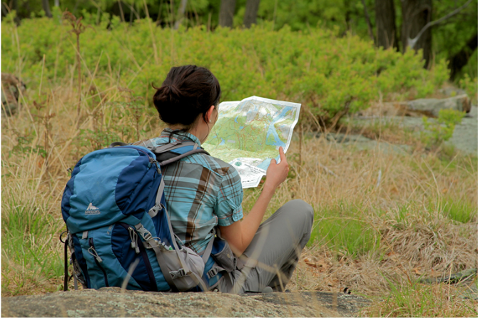
 Support the trails with a donation!
Trip Reports
rate experience
No reviews for this hike, click above rate experience link to review this hike
Log in or register to post comments