Fahnestock State Park [Clarence Fahnestock Memorial State Park]


Park Overview:
Largest park in the area with diverse recreational opportunities on 50 miles of marked trails [including the Appalachian Trail], a variety of terrain, and numerous lakes, ponds and streams.
Park Description:
Fahnestock State Park
The 14,000-acre Clarence Fahnestock Memorial State Park is in an historic iron-mining region, and several remnants of that industry remain in mine excavations, stone foundations and the old railbeds used by some trails. The park has hiking trails and multiple-use trails open to bikes and horses. There is a beach on Canopus Lake open in summer and groomed cross-country ski trails open in winter [both have seasonal fees]. A campground is located just east of the park office. Reservations for camping are often required; see Contact Information on this site. The terrain is varied, including hemlock gorges, bald ridge tops with 360° views, second-growth hardwood forest, mountain laurel thickets, and numerous lakes, ponds and streams.
Trails Overview:
Many trails listed can be combined to create circuit hikes. Most trails have rocky sections and are moderately strenuous, with especially difficult and easy exceptions noted below.
- The Appalachian Trail [blazed white] runs through the park. It is usually accessed from NY 301. North of NY 301 the trail roughly parallels the shore of Canopus Lake, with a beautiful view of the lake at 2.3 miles. South of NY 301 the trail follows an old mine railbed.
- The Cabot Trail [white blaze; 1 mile] has gentle terrain and a short unmarked side trail to a pleasant viewpoint over Jordan Pond. It connects with the Charcoal Burners Trail and the Perkins Trail to make a 1.9-mile loop.
- The Candlewood Hill Trail [red blaze; 2.1 miles one way or 3.5-mile loop] ascends Candlewood Hill, sometimes steeply, to long views in all directions.
- The Catfish Loop [red blaze; 4.7 mile] is accessible where the Appalachian Trail crosses Dennytown Road and is a full loop west of the road. It passes through a wide variety of terrain typical of the area.
- The Cedar Ridge Trail [yellow; 0.8 mile] follows an easement on a private farm through meadows to a view of the Hudson River. Please leave all farm gates through the fields as you find them (open or closed)
- The Charcoal Burners Trail [red; 3.3 miles], along with the Appalachian Trail, connects the north and south sections of the park. It follows a gently rolling ridge and provides access to the Perkins Trail and the Cabot Trail, also connecting with the Fahnestock Trail and the Wiccopee Trail.
- The East Mountain Loop [red; 1.5 miles] crosses over the top of East Mountain.
- The Fahnestock Trail [blue blazes; 7.3 miles] is the main east-west trail north of NY 301. This trail covers a wide variety of terrain, including a very steep climb to the top of Round Hill providing long views of the Hudson.
- The Old Mine Railroad Trail [yellow; 1.6 miles], true to its name, in part follows the railbed of a Civil War era mule-drawn railroad used to haul iron ore. Consequently, it is quite level, with only one short rocky hill after it leaves the railbed.
- The Pelton Pond Nature Trail [yellow; 1.5 miles] is the most-used trail in the park. Located across NY 301 from the park office, it is a level and scenic stroll circling the pond. There is a pavilion built by the CCC, a restroom, and a picnic area. A side trail leads to the Nature Center, which is open in summer. No dogs are allowed on this trail.
- The Perkins Trail [yellow; 4.0 miles] encompasses rolling ridges, hilltop farm fields, views, and a long descent to a scenic stream. Please leave all farm gates through the fields as you find them (open or closed).
- School Mountain Road [white; 4.1 miles] is a multi-use woods road that connects with several other trails. These side trails are foot traffic only.
- The Three Lakes Trail [blue; 3.7 miles] is named for the three lakes it encounters on its meandering path. It begins at NY 301, crosses Sunk Mine Road, and ends at Dennytown Road.
- The Wiccopee Trail [blue; 1.9 miles] is a scenic and lightly used connector between the Charcoal Burners Trail and School Mountain Road in the northernmost section of the park.
- There are two multi-use trails that are open to horses and mountain bikes. One is blazed yellow and starts at Indian Brook Road, and the other is unblazed but starts at the Pelton Pond parking area. See also the trails in Clear Lake Scout Reservation, which connect with Fahnestock trails.
To find detailed descriptions of specific hikes, click here and scroll down the "Parks" column to the name of this park.
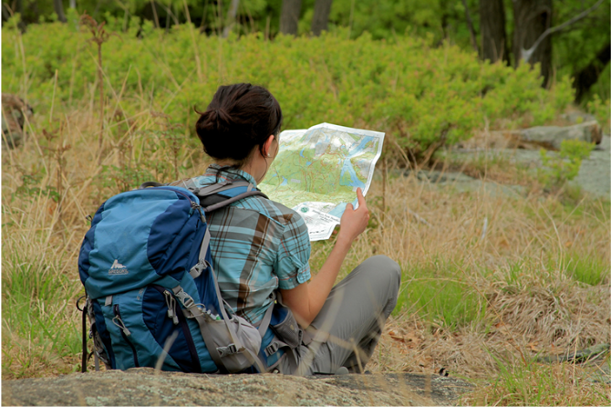
Maps: A detailed trail map can be purchased from the New York-New Jersey Trail Conference (click on East Hudson Trails Map at top).
Park Acreage:
14086.00 acresMunicipality:
Philipstown, Putnam ValleyLargest park in the area with diverse recreational opportunities on 50 miles of marked trails [including the Appalachian Trail], a variety of terrain, and numerous lakes, ponds and streams.
Fahnestock State Park
The 14,000-acre Clarence Fahnestock Memorial State Park is in an historic iron-mining region, and several remnants of that industry remain in mine excavations, stone foundations and the old railbeds used by some trails. The park has hiking trails and multiple-use trails open to bikes and horses. There is a beach on Canopus Lake open in summer and groomed cross-...
Park Acreage:
14086.00 acresMunicipality:
Philipstown, Putnam ValleyContact Information
Web Link:
New York State Office of Parks, Recreation and Historical PreservationPhone:
(845) 225-7207Fees:
Some times and places; check with parkDogs in park:
Dogs on leash
Directions to Trailhead :
Fahnestock State Park is located along NY 301 between US 9 and the Taconic State Parkway. The park office is on NY 301 less than a mile west of the Taconic State Parkway. Parking for many trails is available in several locations along NY 301. See trail overviews for other trailhead parking. The park is not easily accessible by public transportation; the nearest Metro North station is 8 miles away in Cold Spring.
TRAIN TRANSPORT :
Not availableBUS TRANSPORT :
Not availableShare Your Experience
 Support the trails with a donation!